Publication details
First published . Series dates place related notes together in the reading archive.
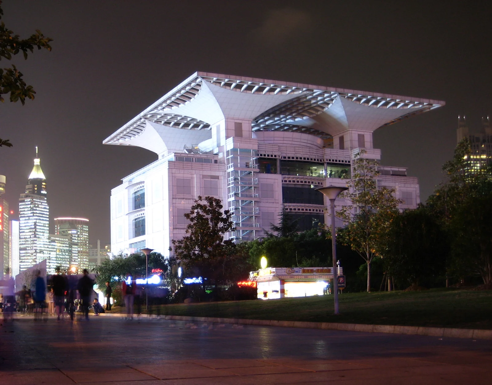

A museum about decisions still unfolding
A history museum can give an object a finished date. A planning exhibition deals with a more awkward subject: a city still being made. At 100 Renmin Avenue, the Shanghai Urban Planning Exhibition Center presents that process through maps, models, displays and policy themes. I think it becomes much more useful when you stop asking whether the city looks impressive and start asking how the different parts are supposed to work together.
The Chinese address is 上海市黄浦区人民大道100号, and the venue is 上海城市规划展示馆. This is a People's Square visit, not a trip out to a new-town development. The location gives you a good testing ground immediately outside: major public institutions, large roads, pedestrian routes and open space. Keep those physical relationships in mind. They are a useful counterweight to any view of Shanghai in which everything becomes a clean diagram seen from above.
Wednesday is the practical detail to remember
The normal published opening pattern is 9:00–17:00, last admission at 16:00, with Wednesday closure rather than the Monday closure common to many museums. I would put that fact in the calendar before planning a combined museum day. The official booking channel has used the 上海城市规划展示馆门票 mini-program, with on-site reservation also documented. Check the current official visitor page for the active route instead of buying an unnecessary third-party product.
My suggested visit is about 90 minutes, not because the building cannot occupy longer but because concentration is more useful here than endurance. The museum itself supplies several route lengths, including shorter options. If you have only 45 minutes, select the city overview, the large-scale model presentation and one topic that interests you. An abbreviated visit can still be thoughtful. A hurried attempt to see every planning theme tends to turn specific questions back into an indistinct impression of size.
Orient yourself before chasing the spectacle
The first-floor material includes Shanghai's overall planning history. I would begin there even if the model is the photograph you came for. Plans have dates, priorities and geographical limits. A map of one planning stage is not a timeless explanation of everything you see outside. Look for what the display treats as the relevant city: the central built-up area, the municipality, or a much wider regional system.
That shift of scale is essential in Shanghai. A visitor's walk may cover several streets, while a planning document is discussing transport hubs, ecological land and connections across the Yangtze River Delta. The two can seem unrelated until you ask how a large decision reaches a small journey. Does a proposed connection change where people can live? Does a protected area shape where building happens? Those are more interesting questions than simply counting towers in a model.
The model is strongest when you resist its seduction
The third-floor route includes a digital immersive city-model presentation. Large models make relationships visible that are hard to grasp from a taxi: water, transport corridors, clusters of development and the distance between apparently adjacent attractions. I would spend a moment locating a few known points, then move away from identification. The useful next step is asking which features dominate the model and which disappear at its scale.
A beautifully ordered city model cannot reproduce the difficulty of crossing a road, the shade along a pavement or the activity around a small shop. That is a limitation of the medium, not necessarily a failure of the exhibit. I would use the model for structure and the street for experience. Keeping those jobs separate lets you enjoy the visual achievement without confusing a clear representation with an uncomplicated city. Shanghai is allowed to be both legible and messy.
The second floor brings the discussion back to daily life
Urban fabric, historic character, renewal, waterfronts and the 15-minute community life circle appear in the second-floor visitor route. This is where I would slow down if you are interested in how people actually use neighbourhoods. A short access time sounds simple. In practice, a useful daily journey involves destinations, crossings, entrances and the ability to stop. Read the display with one ordinary errand in mind rather than with a skyline photograph.
For example, think about the route between a home, a food shop, a park and a place to sit. Which parts depend on proximity, and which depend on a good public environment? The question makes a policy phrase concrete without requiring you to become an urban planner. It also gives you something to notice later around your hotel. A neighbourhood can look dense on a map while still making a short walk unexpectedly awkward; another can be easy to use without looking spectacular.
Waterfronts are a particularly good test case
The Huangpu River and Suzhou Creek appear in the planning themes, and I would use them to connect this visit with a later walk. A river can be infrastructure, boundary, industrial workplace, ecological corridor and leisure space. A polished promenade photograph shows only one of those roles. Look at how the exhibition describes connections along the water and links back into the surrounding streets, not just the appearance of the river edge.
Then choose one actual stretch to examine. Ask where you can enter, whether the route continues, where shade and seating occur, and what happens at a bridge or a large road. These are small observations with real consequences for a visitor. I do not think a waterfront needs a landmark every few minutes to be successful. A continuous, comfortable route can be the more impressive achievement, precisely because its design does not keep demanding your attention.
Do not leave ecology until you have run out of energy
The fourth-floor route turns towards ecological space, parks, low-carbon development, city safety and rural themes. It is tempting to treat these as a virtuous appendix after the exciting city model. I would do the opposite. Land that remains unbuilt, water that needs managing, and systems that make a large city function belong inside the definition of Shanghai. They are not empty background around the important central buildings.
Look for the relationship between a constraint and a choice. If a plan protects space or manages risk, what sort of development does that encourage elsewhere? You do not have to endorse every answer to find the question worthwhile. It changes the visit from a display of projects into a discussion of trade-offs. For me, that is what justifies spending time in a planning museum: it can make apparently inevitable features of a city look like decisions again.
Finish with a modest field exercise
Afterwards I would walk through a small part of People's Square and choose one journey to assess: crossing to a park entrance, finding somewhere to sit, or reaching the next museum. Observe the route rather than grading the whole city. Where does the diagram work, and where does everyday behaviour supply an adjustment? You will get more from ten specific minutes than from announcing that Shanghai is either brilliantly planned or impossibly overwhelming.
This exhibition pairs well with Shanghai History Museum, but the comparison needs a pause. One puts the contemporary city into historical sequence; the other explains intentions and future directions. I would ask one shared question in both places—who gets access, how transport changes space, or how old buildings are reused. That creates a coherent half-day. It also leaves you with a question you can keep using, which is a better souvenir than a photograph of a model you cannot quite identify.